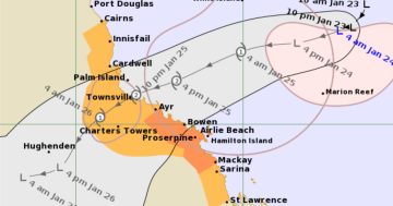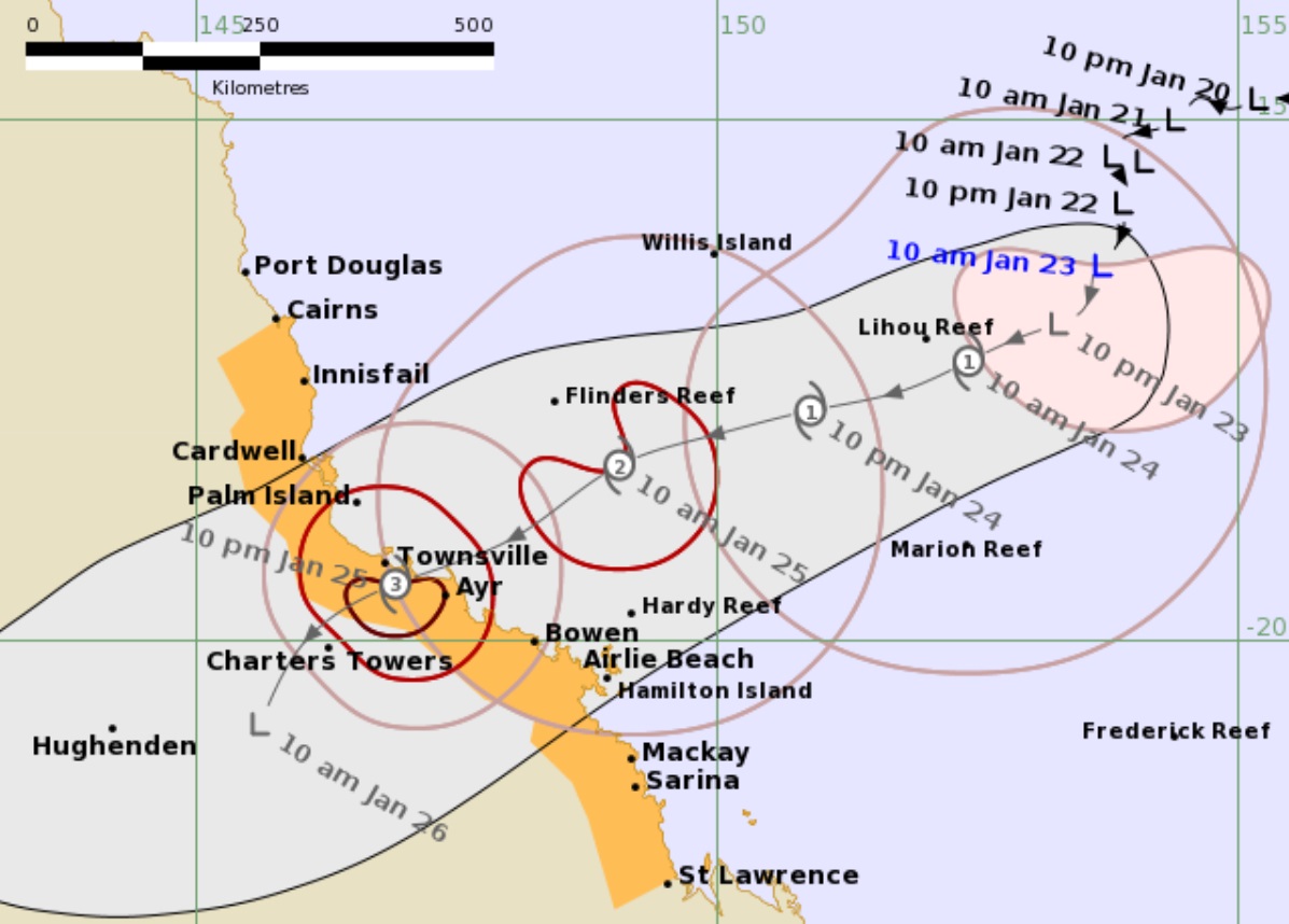
The predicted track of Tropical Cyclone Kirrily as of 10:50 am AET Tuesday (23 January) shows the main impact area is likely to be between Townsville and Ayr. Image: BoM.
Despite still not being fully recovered from the hammering it took from Tropical Cyclone Jasper before Christmas, North Queensland is bracing itself for another cyclone.
A low-pressure system that has been lingering in the Coral Sea for several days about 1000 kilometres east of Port Douglas is expected to form into Tropical Cyclone Kirrily late on Tuesday, before turning southwest towards the Queensland coast.
The Bureau of Meteorology (BoM) is predicting the cyclone may make landfall between Cardwell in the north and Airlie Beach in the south as a Category 2 or 3 storm, with the eye tracking to pass between Townsville and Ayr sometime late Thursday night (25 January).
After crossing the coast the storm is expected to quickly weaken to a tropical low, and move south across central and southern Queensland over the weekend, bringing more rain to the already saturated southeast.
In a media conference on Tuesday (23 January) morning, Queensland Premier Steven Miles said he had just come from a Queensland Disaster Management Committee meeting for the state’s response to what they expected to be Tropical Cyclone Kirrily.
He said the BoM was warning coastal residents between Townsville and Mackay of dangerous storm tides, and that people in these areas should take measures to protect their property as much as possible, and be prepared to follow authorities’ instructions.
“It’s now critical that everyone in the area from Cardwell to Airlie Beach monitor the Bureau’s warnings and warnings that come from their local government areas,” he said. “Widespread flooding is expected to follow the cyclone crossing the coast.
“The crossing and flooding are likely to impact highly populated areas like Townsville and Mackay and Rockhampton,” he added. “It’s incredibly important that individuals and households prepare themselves.”
He said Energex and Ergon were pre-deploying energy workers into the region so they could be as close as safely possible and be ready to move into areas of damaged infrastructure caused by the cyclone.
In the briefing, a BoM representative said the storm was intensifying and it would likely reach cyclone strength overnight Tuesday or early Wednesday. She said the chance of the storm being a severe tropical cyclone when it made landfall remained, but had reduced overnight. She said it would likely be a Category 3 storm when it crossed.
She said communities from Townsville to Mackay and the Whitsundays could expect increased impact within the next 24 to 48 hours. The BoM website watches and track maps will be updated with the latest information every six hours, and warnings will be updated every three hours.
Gale force winds of up to 120 km/h and destructive gusts of up to 150 km/h will develop on the southern side of the cyclone from Wednesday evening.
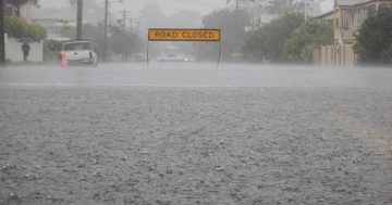
Storm tides and intense rainfall with flash and riverine flooding can be expected from late Wednesday, and the rainfall and flooding is expected to spread inland and north as far as Cairns on Thursday.
She said many of the water catchments in the region were already very wet or saturated, so they were expected to respond very quickly from heavy rainfall.