Australia is not saying El Nino has arrived here yet although we’re receiving hot and dry weather and it’s getting warmer. Expert reporter * Tyne Logan explains why.
 The Australian Bureau of Meteorology (BoM) has yet to call that El Niño has arrived while the Northern Hemisphere swelters through intense heatwaves.
It’s coming as intense heatwaves gripping the southern United States, the Mediterranean, North Africa, the Middle East and some Asian countries, including China.
In its fortnightly climate update the BoM kept the status of El Niño at “alert”, meaning the odds remained at a 70 per cent chance of the event developing in coming months.
So why is the bureau holding off?
Waiting to couple up
Sea surface temperatures in the central and eastern Pacific have met the BOM’s threshold for El Niño, but atmospheric conditions have not.
El Niño is known as a “coupled” event and the BoM’s criteria is stricter than other agencies’ — it wants to see the atmospheric conditions fall in line before it is ready to make a call.
BOM El Niño criteria:
1.The temperature in the central or eastern Pacific must reach a certain level of warming above average and must be projected to stay that way until the end of the year, and:
- The Walker Circulation has to have weakened, which is determined by the strength of the trade winds in the western and central Pacific over the previous four months.
The difference in surface air pressure between Tahiti and Darwin must reach a certain value.
According to the Bureau, the threshold for sea surface temperatures, which is 0.8 degrees warmer than normal in the central or eastern Pacific, has been met for some time.
“But so far neither of the atmospheric criteria, which includes the trade winds and Southern Oscillation Index (SOI), have been met,” it said.
“The SOI, which is a measure of surface air pressure, briefly hit threshold of -7 in June, but has since gone the other way.”
The Bureau’s 90-day-average values of the SOI need to be at least -7 for an El Nino to be declared. In recent weeks the values have gone the other way.
Matters of contrast
The Bureau said there were several factors that could cause a delayed atmospheric response, but in this instance ocean temperatures are the likely drivers, according to the climate scientists.
“Sea surface temperatures are not just warm in the central and eastern Pacific — they are warm everywhere, including on the western side of the Pacific,” the scientists said.
“During El Niño, sea surface temperatures on the western side of the Pacific are usually cooler than normal and the contrast drives changes in wind patterns.”
“We need the contrast between the central Pacific and western Pacific, and at the moment it’s still too weak to make the trade winds weaken and put in an El Niño phase by the Bureau of Meteorology thresholds,” the chief investigator at the Australian Research Council Centre of Excellence for Climate Extremes, Andréa Taschetto said.
“The world’s oceans have been at record high temperatures for months now, according to data from the US,” she said.
She said water temperatures near Australia did not have to become unusually cool for the trade winds to weaken, but there needed to be a stronger difference between each side of the Pacific than was the case presently.
The conditions in the ocean near Australia have been shown to play a role in the impacts of El Niño, too.
A question of warmth
A study of the 1997 El Niño , led by Peter van Rensch, found that sea surface temperatures off the north east coast of Australia, which were only slightly cooler than normal that year, may have played a role overriding the normal dry influence of El Niño on the south-eastern states.
El Niño explained
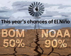
The BOM’s latest climate update keeps the possibility of El Niño at 50 per cent, but the US’s chief forecast agency, NOAA, says it’s a 90 per cent chance.
This was because there was more moisture available in the atmosphere near Australia for weather systems to tap into.
This finding does not guarantee it will be the case in all El Niño years like it, however.
Another reason for the lack of atmospheric response so far has to do with the area where the warmest sea temperatures are, according to Monash University climate scientist Shayne McGregor.
He said large rainfall could help to trigger an atmospheric shift, but the sea surface temperature needed to be above about 27 degrees for that to occur.
Even though surface temperatures in the central Pacific are higher than normal, they are not warm enough to create heavy rainfall.
“The shape of these sea surface temperature anomalies might not be as conducive to precipitation, or to this ocean atmospheric coupling, as you might expect,” Dr McGregor said.
‘A little bit unusual’
Delays between the ocean and atmosphere lining up are not unheard of, but Dr Taschetto says it usually does not take this long.
“It can take a while, but at the moment it’s a little bit unusual that the ocean is in an El Niño pattern and the atmosphere is not responding to it,” she said.
She said there was still plenty of time for an El Niño to be called and that historical records showed it had developed during September, October and November in the past.
There have also been cases when the atmosphere has never swung into El Niño mode, despite strong warming in the ocean.
The most recent example occurred in 2014, when a strong El Niño was forecast but did not kick in until the following year.
Dr Taschetto said it was too early to say whether this year would be similar to 2014.
At the moment, however, the odds are in favour of an El Niño developing.
What’s the difference?
El Niño is a major factor in the world’s climate and helps climatologists project the general climate patterns several months in advance.
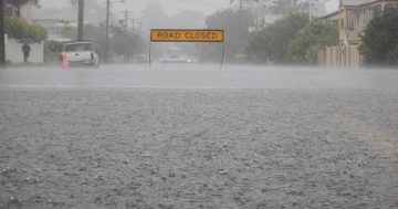
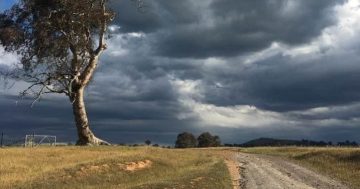
But it is not the be-all and end-all of weather outlooks, especially for the next three months. Even without El Niño being declared much of Australia is forecast to be dry during spring.
The BoM often encourages people to look to its long-range forecasts for the best guidance on likely climate outcomes.
This outlook factors in the physics of the atmosphere, oceans, ice and land.
It also incorporates climate change and natural climate drivers such as El Niño.
Story written by *Tyne Logan, the ABC Perth’s weather and climate reporter.