 The State Library of NSW has launched a new exhibition inviting visitors to explore the beauty, art and science of mapping across three centuries.
State Librarian, John Vallance said the star of the show was one of the Library’s “most irreplaceable” objects, Abel Tasman’s hand-drawn 1642-44 map, which was on display for the first time in a decade.
Dr Vallance said the map had undergone a 380-hour restoration operation to look as good as it did over 300 years ago.
“Twelve months of intense conservation work – with state-of-the-art techniques never attempted before at the Library – went into preparing the Tasman map for exhibition,” he said.
“The work revealed previously obscured details which were hidden under a thick layer of yellow varnish.
“After a few false starts due to COVID, at long last we can welcome visitors to our Maps of the Pacific exhibition and show off some of the largest and most spectacular objects in the Library’s important collection of maps.”
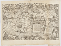
Dr Vallance said Abel Tasman’s 1642-44 map was joined by almost 100 rare and priceless maps, charts, atlases and globes in the new exhibition, open until 24 April.
“On a deeper level, the exhibition gets us thinking in unexpected ways about how we got here and why,” he said.
Manager, Research & Discovery and exhibition curator at the State Library, Maggie Patton said the exhibition was an opportunity to display items never or rarely placed on display, as well as important items from private and public collections, including a Marshall Islands stick chart on loan from the National Library of Australia.
“While this exhibition traces the European mapping of the Pacific using western viewpoints and cartographic traditions, the Library acknowledges that Pacific First Nations people navigated the Pacific using their shared knowledge of ocean paths, prevailing winds and rising stars for millennia,” Ms Patton said.
Further information on the Library’s Maps of the Pacific exhibition can be accessed at this PS News link.
