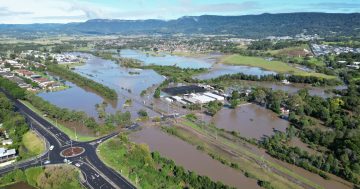
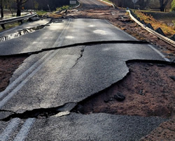
 World-first technology is to be used in Victoria to assess the condition of the State’s flood-ravaged roads as part of the current emergency road repair blitz.
Minister for Roads and Road Safety, Melissa Horne, announced that the Australian Road Research Board’s Intelligent Pavement Assessment Vehicle (iPAVe) would join the blitz, assessing the condition of more than 8,400 kilometres of Victoria’s roads in the wake of recent floods and extreme rainfall.
“The collected data will help plan for upcoming large-scale repairs and road maintenance across both regional and metropolitan Victoria,” Ms Horne said.
“Equipped with a range of data collection systems, iPAVe is capable of assessing both the structural and functional condition of the road, using laser technology developed in Denmark to look at characteristics including roughness, surface texture and rutting,” she said.
“Cracking and other surface data is assessed using an automated 3D monitoring system, while cameras mounted to the truck’s exterior will give road maintenance experts a first-hand look at the State’s road network.”
Ms Horne said that with an on-board ground-penetrating radar, the iPAVe could also collect sub-surface data at the same time, “giving experts a better understanding of what’s happening underneath the road surface”.
She said both datasets were collected at the same time, in one trip, at highway speed – which made the iPAVe a cheaper, faster and safer way to collect intelligence.
“Data collected as part of iPAVe’s most recent assessments will then be compared with similar information collected in 2021 to gauge the full impact of the recent floods,” the Minister said.
“More than 170 of the State’s roads will undergo inspection by iPAVe, including major freight and tourist routes like the Hume, Western, Midland, Goulburn Valley and Calder highways.”


