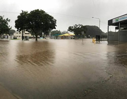
 A flood mapping project trial aimed at better managing risk mitigation for primary producers is to be launched by the Department of Agriculture and Fisheries with support from primary sector organisations.
Minister for Agricultural Industry Development, Mark Furner said Queensland was struck by natural disasters each season and needed access to the latest cutting-edge tools and technologies to better manage the risks.
“Under this trial, involving 10 producers, a flood map will be generated for each property with a customised risk mitigation and management plan,” Mr Furner said.
“Mapping will be supported by a workshop and on-farm discussions to assist producers in understanding their flood risk, and to look at options to mitigate flood impacts long term through management decisions and strategies.”
He said he hoped the project would lead to improved understanding of flood vulnerabilities for specific agriculture industries and farm locations.
Mr Furner said other potential benefits included the identification of beneficial infrastructure projects such as designing farm road access to minimise supply chain impact; improving plans for managing livestock when floods approached; and information regarding timing and location of planting crops.
“The project will also increase resourcing of spatial data mapping services to build a comprehensive flood mapping resource for Queensland,” Mr Furner said.


