 The Department of the Environment and Energy’s Australian Antarctic Division (AAD) has launched its summer research season, joining the United States’ National Aeronautics and Space Administration (NASA) in a world-first mapping of the East Antarctic coastline.
NASA’s Operation IceBridge is the largest survey ever undertaken of the world’s polar regions, using a low-flying Gulfstream V aircraft with high technology instruments flying out of Hobart.
At the same time ground teams, including two NASA scientists, will move along the same travel path of the aircraft and a polar-orbiting satellite, collecting ice cores and measuring snow cover to confirm what is recorded from above.
Minister for the Environment, Sussan Ley said measurements of the world’s ice sheets would improve projections of future sea level change caused by a changing climate and allow more accurate forecasts of annual sea ice extent.
“The partnership with NASA is one of the many scientific endeavours that will be undertaken by the Australian Antarctic Program (AAP) in the months ahead,” Ms Ley said.
“This year more than 550 expeditioners will travel south from Hobart with the AAP supporting and undertaking research on seabirds, glaciers, the ice cap and the Southern Ocean.”
She said other projects would include biological and geotechnical surveys around the site of Australia’s proposed new runway near Davis research station, and a new station on Macquarie Island.
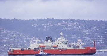
The first of 10 Airbus flights this season have already left Hobart with the icebreaker, Aurora Australis departing today (25 October).


