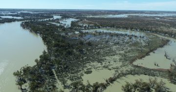
Floodwaters near Innamincka in the state’s far northeast. Photo: DCCEEW.
Despite most of the inhabited regions of South Australia being in a deep drought, areas of the state’s vast northeastern inland that have been affected by flooding will soon receive joint state and federal disaster assistance funding.
The floods stem from extensive rain over western Queensland and northwestern NSW in February and March, with the vast areas of inland flooding that was left from that weather making its way down Queensland’s Georgina, Diamantina and Warburton rivers to the Thomson and Barcoo rivers, Cooper Creek and other tributaries to Kati Thanda-Lake Eyre.
Because of this flooding, the Federal and State governments have activated disaster assistance for communities, councils and primary producers in these remote areas.
The flood peak recently passed Innamincka which saw one of the highest recorded levels of the Cooper Creek in history, exceeding the 1974 record flood level. The SA Government says flooding has caused significant damage to infrastructure including critical road networks, with sections of the Strzelecki and Birdsville tracks likely to be impassable for several months.
The Disaster Recovery Funding Arrangements (DRFA) will provide freight subsidies to help primary producers transport essential supplies, including fodder, water, and livestock. The subsidies will cover 50 per cent of transport costs up to $5000 for eligible activities carried out by primary producers.
Tailored Family and Business (FaB) mentoring is also available through DRFA to support primary producers by offering free, confidential, and independent support to help navigate financial, emotional, and operational challenges from the flooding.
Assistance to deliver exceptional relief and recovery counter disaster operations has also been activated, as well as financial assistance to help with the costs of restoring or repairing essential public assets.
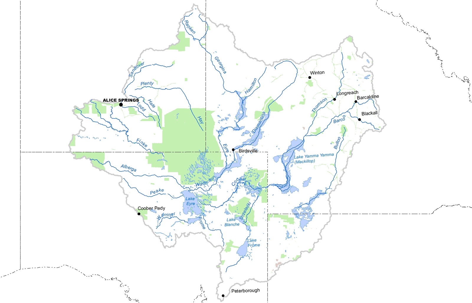
The vast Kati Thanda catchment area covers an area larger than South Australia itself. Image: BoM.
Federal Minister for Emergency Management Kristy McBain said these remote communities were facing hard conditions after flooding.
“The scale of this flood event is historic, and our focus is on helping local people and producers stay connected, supported, and safe,” she said.
“Road access is critical for recovery, that’s why this support will help maintain vital supply lines and keep businesses moving.”
South Australian Minister for Emergency Services Emily Bourke added, “Ensuring the wellbeing of our regional communities and the resilience of our primary industries is a top priority for the Malinauskas Government.
“As the flooding situation unfolds in the far northeast, we are providing support to affected pastoral properties and communities so they recover as quickly as possible.”