 The Natural Resources Access Regulator (NRAR) has declared that its work with the Murray–Darling Basin Authority (MDBA) and Geoscience Australia (GA) had led to it conducting the largest and most systematic monitoring effort in its history.
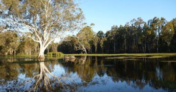
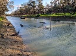
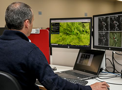
Chief Regulatory Officer at NRAR, Grant Barnes said the Regulator used satellite data to monitor an environmental flow as it travelled across 306,400 square kilometres and past more than 3,500 on-farm storages.
“As a result of our partnerships with the MDBA and GA, NRAR now has eyes in the sky,” Mr Barnes said.
“We’ve worked with these Agencies to access satellite data from world-leading technology providers to monitor an environmental flow as it travelled throughout the State,” he said.
“This was the biggest monitoring effort in our history.”
Mr Barnes said the NRAR had increased its capacity to monitor on-farm storage units by almost 500 per cent, from 600 to 3,500 storage units.
He said the technology also allowed the Regulator to respond to 748 suspicious activity reports and take 943 enforcement actions in 2020.
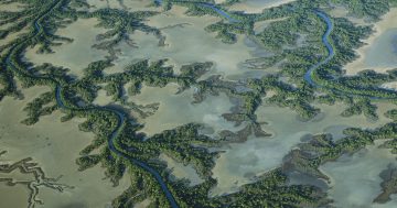
Head of Basin Strategy and Knowledge at MDBA, Vicki Woodburn said the Authority had built its independent science capability, including the MDBSat platform, to monitor and evaluate the benefits of water reform across the Murray-Darling Basin at a landscape scale.
“We use the MDBSat platform to track how floodplain vegetation responds to environmental water, as well as to monitor the speed, flow and spread of water through the landscape,” Ms Woodburn said.